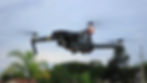
What We Do
We combine advanced drone technology with industry expertise to deliver the high-resolution data you need—from automated meter reading (AMR) to agriculture—so you can reduce risks, accelerate timelines, and act with clarity.
Our Industries:
→ Utilities & Infrastructure
→ Agriculture & Land Management
→ Real Estate & Construction
→ Environmental Monitoring


Safety First
→ Inspections without putting people in hazardous situations.
Sharper Data
→ High-resolution imaging and thermal scans for smarter planning.
Utility Expertise
→ Automated meter reading and imaging solutions that improve efficiency and accuracy.
Faster Results
→ Quicker turnaround to keep projects on schedule.
Custom Solutions
→ Tailored support for utilities, construction, agriculture, and more.